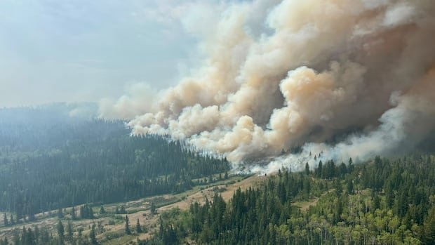
The notification comes as crews continue work to contain multiple fires across the province, including those in the northwest where recent satellite imagery has captured smoke plumes rising from large burn areas. Forecasters warn that gusty winds accompanying the cold front could complicate suppression efforts by spreading embers and accelerating fire spread in susceptible terrain.
While no new ignition sources were officially reported in connection with the front, authorities are urging residents and visitors to stay informed about local fire advisories and road closures. The updated weather outlook emphasizes that wind shifts can influence fire behavior dramatically, particularly in forested regions with dry conditions.
Response agencies are coordinating resources to respond to any rapid changes in fire activity. This includes maintaining readiness to deploy additional personnel, equipment, and water delivery systems if needed. Officials also reaffirm the importance of personal safety measures for those living near or traveling through affected zones, reminding residents to heed evacuation orders and to prepare go-bags should conditions deteriorate.
The forecast energy from the incoming front contrasts with the more stable conditions reported earlier in the week. As fire crews monitor hot spots and secure containment lines, the provincial service continues to assess evolving weather patterns to guide ongoing suppression strategies.
Authorities reiterate that updates will be issued as new information becomes available, including any changes to ignition risks, wind speeds, and potential impacts on containment progress. For now, residents in at-risk districts are advised to remain vigilant, monitor official briefings, and comply with any direction from local emergency management authorities.