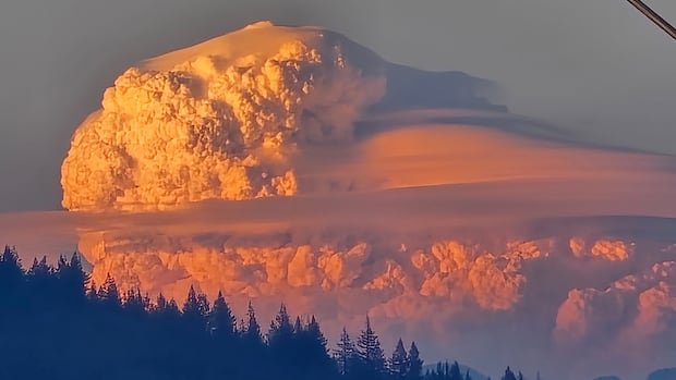
Pyrocumulonimbus clouds develop when a wildfire generates extreme heat, lifting rising air and drawing in surrounding moisture. As the air rises, it cools and condenses, forming a towering, anvil-shaped cloud that can reach into the upper atmosphere. These clouds are capable of injecting smoke and embers miles from the fire, potentially spreading the blaze and complicating suppression efforts.
Experts note that several contributing factors can lead to pyrocumulonimbus development, including intense fire intensity, favorable wind patterns, and high humidity levels that supply the necessary moisture. The French event marks a notable departure from the more frequent occurrences of pyrocumulus and pyrocumulonimbus observed in North America, where climate conditions and fire behavior have historically facilitated their formation.
Officials emphasized that the appearance of such clouds should not be mistaken for ordinary weather phenomena. Pyrocumulonimbus clouds can generate strong updrafts, lightning, and unpredictable fire behavior, increasing risks for firefighters and nearby communities. Meteorologists are studying the incident to understand how regional climate trends may influence future occurrences in France and Europe.
There was no immediate report of casualties tied to the cloud event, but authorities continue to monitor the wider wildfire situation as embers and shifting winds threaten new flare-ups. The France fire response includes aerial suppression and ground crews working to establish containment lines, supported by weather services tracking atmospheric developments linked to the blaze.
The French case underscores a growing focus on extreme fire behavior and its atmospheric byproducts, with researchers urging communities in fire-prone regions to remain vigilant about changing fire dynamics and associated hazards.